Our services
Drone & UAV Surveys for Rail & Infrastructure
CAA-authorised drone LiDAR and photogrammetry surveys of railways, stations and structures — planned, flown and delivered by surveyors.
Infrastruct North flies CAA-authorised drone surveys of railways, stations, viaducts, roofs and hard-to-reach structures — and because we’re surveyors first, the data lands as deliverables your engineers can actually use. LiDAR point clouds, photogrammetry models, orthophotos and inspection imagery, captured under our own Operational Authorisation by GVC-qualified pilots and tied into ground control by the same RISQS-accredited team that measures track and monitors structures every week.
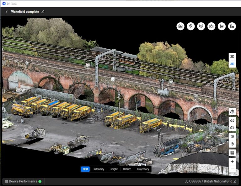
Recent flights include the 99-arch viaduct at Wakefield and an operational railway station at Flint, alongside station roofs, culverts and drainage catchments across the network. Most drone operators hand you data and leave; most survey firms subcontract the flying. We do both jobs as one — plan, fly, process and deliver — with one contract and one team accountable for accuracy from flight plan to final drawing.
Why use a drone for infrastructure surveys?
Because the alternative is usually putting people somewhere difficult. A drone captures a viaduct parapet, a station roof or a structure spanning live track in minutes, from positions no MEWP, scaffold or rope-access team can reach economically — and often without anyone needing track access at all. You get complete, repeatable coverage: every arch, every gutter, every face, photographed and measured in one visit, with far less time on or near the infrastructure. For condition inspections, defects are found from the imagery rather than from a ladder. For measured surveys, it means dense, survey-grade data over areas that would take days on foot.
What we capture
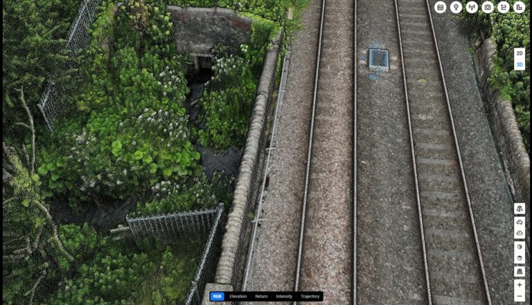
- LiDAR — dense point clouds of structures, embankments, vegetation and drainage, captured even where photogrammetry struggles, and delivered ready for CAD and BIM workflows alongside our laser scanning data
- Photogrammetry — high-resolution 3D models, orthophotos and elevations for condition reporting and visual records
- Inspection imagery — close-visual photography and video of defects, joints, bearings and roof details, referenced so an engineer knows exactly what they’re looking at
Drone surveys work best on viaducts and bridges, where face-by-face access is the whole cost of the job; station roofs and canopies, where closure is unthinkable and access is miserable; culverts, watercourses and drainage catchments, where LiDAR reveals the ground under the vegetation; embankments and cuttings; depots and yards; and any structure spanning something that must stay open — track, road or water. If scaffolding it costs more than surveying it, it’s a drone job.
Our approach
A drone is a data-capture tool; the value is in what the data becomes. Our flights are planned and processed by land surveyors: control established on the ground, accuracy verified against it, outputs drawn to the same standards as our topographic surveys. If your project also needs track monitoring, structural monitoring or a topo of the wider site, it’s one team and one contract — the drone data registers with everything else, instead of arriving as an orphan dataset in the wrong coordinate system.
Flying near live railways is most of what we do. Every flight is planned through our own RAMS process — airspace checks, notifications to the infrastructure owner (including Network Rail’s drone-notification process), emergency procedures and weather limits — all agreed before anyone mobilises. Many rail structures can be captured with no possession and no track access, flying from adjacent land with the landowner’s permission, which is often the difference between a survey this month and a survey next control period. Where the job does need railway safety cover, we arrange it as a RISQS-accredited rail contractor.
- Scope. Tell us the asset and the output you need — inspection imagery, a measured model, or both.
- Plan. We produce the RAMS, secure permissions and landowner agreements, make the notifications and pick the weather window.
- Fly. Typically a short site visit by a small team — often a lone pilot from adjacent land, with observers and safety cover where the plan requires them.
- Process and deliver. Flight data becomes checked, controlled deliverables, reviewed by a surveyor before it reaches you, in the formats your designers asked for.
Equipment and software
- DJI Matrice 300 RTK aircraft carrying survey-grade LiDAR and photogrammetry payloads
- RTK positioning tied to ground control placed and checked by our own surveyors
- DJI Terra and survey-grade point-cloud processing software, with every dataset reviewed by a surveyor before release
- Deliverables to suit the job: point clouds (E57/LAS), CAD drawings, orthophotos, DTM/DSM surfaces, 3D meshes or a straightforward annotated photo report
We operate under a CAA Operational Authorisation in the Specific category, which permits the closer-proximity operations infrastructure work involves. Every flight is flown by GVC-qualified remote pilots to an approved RAMS, and as a RISQS-accredited contractor we bring the same rail safety discipline to the air that we apply on the track.
What you receive
Checked, controlled deliverables your engineer can use:
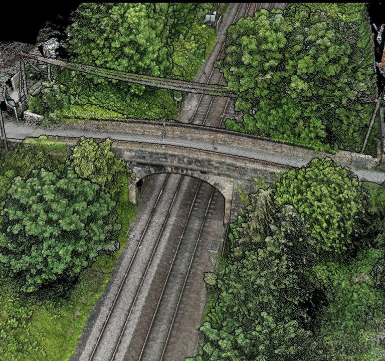
- Registered point clouds (E57/LAS) and 3D models, on your site control and coordinate system
- CAD drawings, elevations and orthophotos drawn to topographic-survey standards
- DTM/DSM surfaces for design and volumes
- Annotated inspection reports with referenced imagery, so every defect can be found again
- A stated, verified accuracy — the tolerance in the quote is the tolerance we check against in processing
Tell us the software your team uses and we’ll deliver to suit it. And because the same company can provide your topographic survey, laser scanning and monitoring, the drone data arrives registered to everything else on the project.

Get in touch
Whether you’d like to discuss a project, are looking for specialist advice, or would like to request a quote, we’d love to hear from you.
Contact an expert